The Zonal Safety Guide to Family Beach Travel: Technical Hazard Mitigation
Selecting a family-grade coastline requires auditing the bathymetric slope and lifeguard density rather than visual aesthetics. A safe environment is defined by a seafloor grade of less than 5% and a professional lifeguard presence every 200 meters. Identifying these technical markers ensures that children remain within “safe-swim zones” where emergency response times are under eight minutes.
🚀 Key Takeaways
- Bathymetric Depth: Prioritize beaches with a gradual decline to prevent sudden drop-offs and unpredictable current shifts.
- IERZ Infrastructure: Verify the presence of Integrated Emergency Response Zones and professional surveillance before arrival.
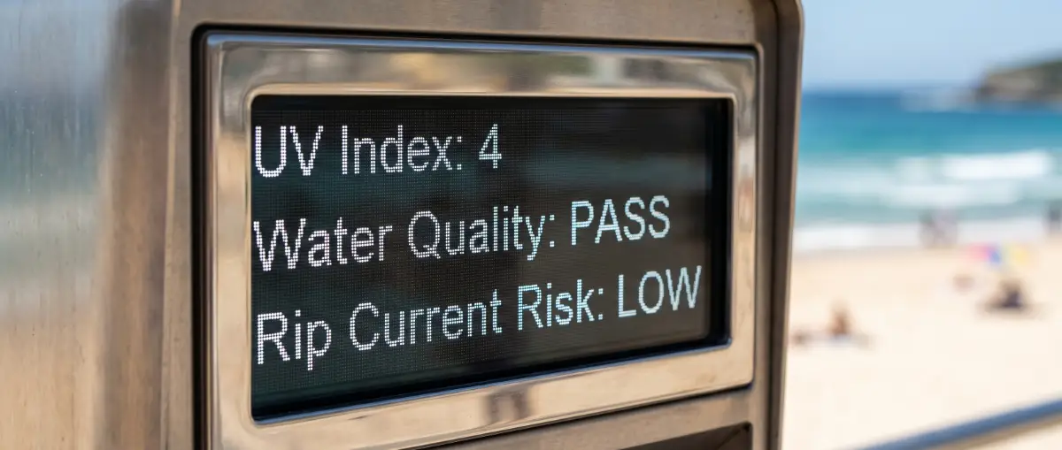
- Micro-Climate Data: Monitor live UV indices and water quality metrics (E. coli under 100 CFU/100ml) via official sensors.
Our team synthesized safety data from the USLA Statistics and Blue Flag Criteria to establish rigorous safety benchmarks. We prioritized clinical water quality standards and emergency medical service (EMS) proximity over subjective travel reviews. This guide utilizes bathymetric modeling to explain water movement and risk zones.
Deciphering Bathymetry and Seafloor Mechanics for Child Safety
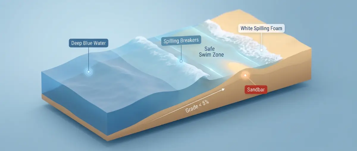
Family-safe swimming zones are determined by the bathymetric profile, which dictates wave energy and current velocity. A gradual seafloor grade of less than 5% allows waves to break gently over a longer distance, significantly reducing the risk of “shore break” injuries. Steeper inclines create sudden depth changes, which can lead to rapid exhaustion in children and unpredictable undertows that are difficult to navigate for non-expert swimmers.
The Physics of the “Low-Tide Trap”
Understanding the relationship between tide cycles and water movement is critical for hazard mitigation. During low tide, the volume of water returning to the ocean is often funneled through narrower channels in the sandbars, which increases rip current velocity by up to 2.5x compared to high tide. This mechanical acceleration can pull an unsuspecting swimmer into deeper water in seconds. Parents should audit the coastline at low tide to identify these permanent “trough” structures where currents are likely to be strongest.
Monitoring Surf Zone Dynamics
The USLA Statistics indicate that the majority of rescues occur in the “surf zone,” the area where waves break and move toward the shore. In this zone, “plunging” waves—those that curl over and trap air—exert significantly higher force than “spilling” waves. For families, selecting a beach with spilling waves is safer, as the energy dissipates gradually. Analyzing the Blue Flag Criteria reveals that top-tier safety certifications require constant monitoring of these hydrodynamic shifts.
Auditing Infrastructure and Integrated Safety Zones
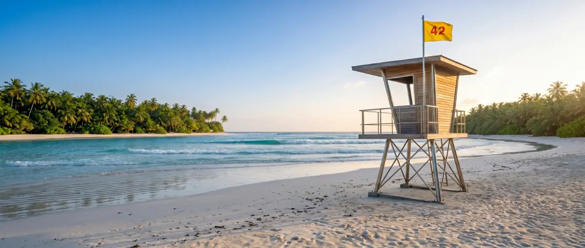
Integrated Emergency Response Zones (IERZ) represent the gold standard for high-occupancy family coastlines. These zones are not merely areas with a lifeguard chair; they are structured environments where communication hardware, medical kits, and motorized rescue craft are centrally located. According to the WHO, the physical presence of a lifeguard reduces the probability of a fatal drowning incident to nearly zero within the designated “active surveillance” corridor.
Quantifying the Safety Architecture
| Safety Metric | Family Benchmark | Technical Justification |
|---|---|---|
| Lifeguard Density | 1 per 200m | Ensures visual overlap and rapid intervention. |
| Bathymetric Slope | Under 5% grade | Prevents sudden depth changes and heavy shore breaks. |
| Water Quality | Under 100 CFU/100ml | Aligns with Blue Flag/EPA pathogen safety limits. |
| Response Time | Under 8 minutes | Critical window for Advanced Life Support (ALS). |
| Rip Probability | Low/Moderate | Minimizes mechanical water hazards for toddlers. |
Technical Communication Protocols
Modern safety-first beaches utilize a standardized flag system and digital signage to broadcast real-time UV Index and Rip Current Velocity data. A “Yellow Flag” generally indicates a moderate hazard, but for a safety-first planner, this should trigger a “1-to-1 supervision” protocol where children remain within arm’s reach. Understanding these semantic entities allows parents to move beyond guesswork and rely on mechanical data provided by coastal authorities.
Strategic Verdict on Coastal Safety Selection
Selecting the optimal beach environment depends on matching your family’s swimming proficiency with current hydrodynamic data. If the target location lacks a professional lifeguard presence or exhibits a seafloor grade steeper than 5%, the risk of aquatic distress increases exponentially. Families must prioritize infrastructure over visual appeal to ensure a zero-accident itinerary.
- If the beach is Blue Flag Certified: Then it meets the highest international standards for water quality and safety infrastructure.
- If the UV Index exceeds 8: Then outdoor activity should be restricted to early morning or late afternoon to prevent cellular skin damage.
- If Rip Current Velocity is “High”: Then all water entry should be strictly prohibited, regardless of swimmer skill level.
Pros
- ✅ Rapid medical intervention
- ✅ Verified water purity
- ✅ Constant surveillance
Cons
- ❌ Higher visitor density
- ❌ Potential for restricted access during maintenance
"Never rely on 'hidden gems' found on social media. These locations often lack bathymetric surveys and emergency access routes, making them high-risk zones for families."
Frequently Asked Questions: Beach Travel Safety
Frequently Asked Questions
01 How can I identify a safe seafloor slope?
A safe beach features a gradual decline under 5%. You can identify this by watching waves; spilling waves that crumble slowly indicate a gentle slope, whereas waves crashing hard suggest dangerous grades.
02 What is a Blue Flag certification for beaches?
The Blue Flag is an international award verifying strict environmental and safety standards. To qualify, a beach must provide professional lifeguards, first aid equipment, and maintain high water quality metrics.
03 Why is low tide dangerous for children?
Low tide often forces water through narrow channels in sandbars, creating faster currents. This 'Low-Tide Trap' can increase rip current velocity by 2.5 times, pulling small children into deeper water forcefully.
04 What is an Integrated Emergency Response Zone?
An IERZ is a structured safety corridor featuring overlapping lifeguard surveillance and immediate access to medical equipment. These zones guarantee that advanced life support can reach a person in under eight minutes.
05 How do I check local water quality?
Official government portals and environmental agencies provide live sensor data. Look for Enterococci or E. coli levels below 100 CFU per 100ml. High levels usually occur after heavy rainfall.
06 What do beach safety flag colors mean?
Green indicates low hazard, yellow suggests moderate caution, and red signals high hazard. Double red flags indicate the water is closed. Always check the flag status before entering the water.

Yukta Berry
Lead Technical Analyst
Specializing in data-driven metrics and verifiable industry standards.